Virginia’s 40th State Park
Machicomoco is Algonquian for “special meeting place.” The name was chosen to reflect the park’s purpose of education on the native tribes of Virginia.

Machicomoco is Virginia’s first state park focused on honoring and interpreting the history of Virginia’s Indian tribes. It opened to the public on April 16, 2021. Located in the southern part of Gloucester County along the York River, Machicomoco State Park is approximately 10 miles downriver from Werowocomoco.
An open-air interpretive pavilion provides information on the culture, landscape and movement of Virginia Indians through displays and a walking path in the landscape. A paved trail follows along the main park road for walking or bike riding. The surrounding land provides diverse wildlife habitats, from open fields to woodlands and waterfront/marsh areas supporting deer, turkey, and many species of songbirds and birds of prey.

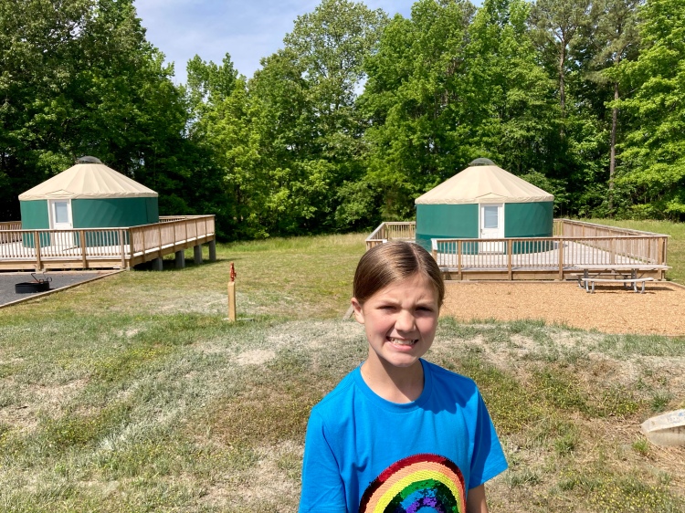
Other amenities include a campground with sites for vehicle camping and hike-in tent sites, three overnight yurts, two picnic shelters, a car-top boat launch pier with an accessible boat entry structure, and a set of small floating docks on Timberneck creek for daytime boat tie-ups and fishing.
Location: 3601 Timberneck Farm Rd., Hayes, VA 23072 (~100 miles/1 hr. 50 min. from Fredericksburg)
Hours: 8 a.m. to dusk
Cost: $5 per car/ Free for homeschoolers with NOI or ID
Trail Guide: Machicomoco State Park
Website: https://www.dcr.virginia.gov/state-parks///machicomoco
Updates:
- As of May 11, reservations are being accepted for campsites and yurts.
- Please come prepared because the park does not sell ice, food or drinks.

We were excited to visit Machicomoco especially since it’s only been open for a month. The drive from the Fredericksburg area is easy and almost a straight shot on Rt. 17. As you get closer to the park, make sure to follow the GPS directions for the address above. You’ll drive through a residential area and then a sign for the park will pop up letting you know that you are heading the right way.
After entering the park and paying, you’ll come to the main road which loops around the entire park. It looks like a one-way road, but it is a narrow two-lane road. There are three main stopping spots along the loop. There’s plenty of parking at each area.
- Camping area: There are 27 camping sites and three yurts. The campground has a bathhouse with restrooms with hot showers. There’s also a water filling station. Sites have fire-rings, picnic tables and lantern holders. Check-in is 4 p.m. You can make reservations online.


- Car Top Launch: At this site you will find an Americans with Disabilities Act-compliant car-top launch that allows guests to explore the Poplar Creek tidal ecology and provides access to the York River. The trail to the boat launch is paved. There’s a small restroom at this site.


- Interpretive Area: This area provides visitors with an opportunity to learn more about the history of Virginia Indians and how they are a critical part of our history today. An interpretive area highlights the history of the Virginia Indians in a timeline-walk and an educational trail. An open-air educational structure, modeled after an Algonquian longhouse, features panels about life, land, community and travel. The landscape plantings in this area feature native plants important to Virginia Indian culture. In the future, interpretive and educational programming will be offered here. There are two large shelters and restrooms here. The picnic shelters can be reserved and accommodate up to 50 people.


There are three trails at the park:
- Forestry: This is approximately 2.4 miles and consists of grass, gravel and dirt portions. A jogger stroller would be able to make it on this trail. Portions of this trail are shaded but others are out in the open with direct sunlight. This trail skirts the wetlands and provides views of the Catlett islands. It’s a great place for birding. The day we went there were lots of flies swarming around us. I would suggest putting on some bug spray before you head out on this trail.


- Interpretive: This trail is the shortest at o.7 miles. It heads to a lookout point near the water. On the way you’ll pass the Timberneck House.


- Loop: This is three miles of a paved trail that parallels the main road. It’s perfect for easy walking or bike riding.

We had a great time at Machicomoco State Park. We loved the variety of the trails and learning more about the Indians that lived in Virginia. My kids also loved using the Seek by iNaturalist app to identify the various plants and insects we found along the trails. Some of our interesting finds were fennel, mock strawberries, and tulip trees. We also saw a gigantic dragonfly the size of an adult hand and a bunch of crabs. We will definitely be back. My kids really want to rent a yurt and go kayaking.
After visiting this state park, make sure to enter your visit in the Virginia State Parks Trail Quest.
On our way home we stopped at NN Burger for my free birthday Freak Shake and looked for a few LOVEworks signs.


We tried to find the Love sign in Warsaw, but unfortunately it is no longer there.
